Royal Alberta Museum
EDM developed two key interactives for the Human History Hall: the totemic Gallery Screens and the Indigenous Placenames Mapping Interactive
The new RAM is the largest museum in Western Canada, spanning 127,700 square metres (419,000 square feet). This includes 24,990 square metres (82,000 square feet) of exhibition space – twice the size of the former museum. The new galleries share more of the countless treasures and stories in the museum’s care, offering visitors a better understanding of what epitomizes Alberta.
The Human History Hall shares compelling stories of who we are, from the earliest people to the Albertans of today. Many of the panels in the museum’s galleries are written in both French and English, and several others include Indigenous languages – Cree, Dene, Blackfoot, Nakota and Michif.


Gallery Screens
At the entrance to the Human History Hall – repeated within each of the gallery’s thematic zones – is a portrait-oriented digital display. These totemic “Gallery Screens” enable visitors to peruse a curated montage of highlight objects in each respective zone.
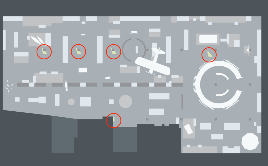
Schematic gallery map from the Human History Hall. EDM interactives indicated by red circles.
The interface is simple: a grid of artefact images that periodically rearranges and refreshes. Touching a tile opens a full-screen popup with information about the object, most importantly, where to find it in gallery. The content is authored by staff using RAM’s new exhibits content-management-system.
The following video shows an early functional design mockup that illustrates grid rearrangement and selection.
This early design was refined through discussions with the client and local testing into the following finalized functional design:


And here is the finalized interactive running in one of the exhibit galleries.
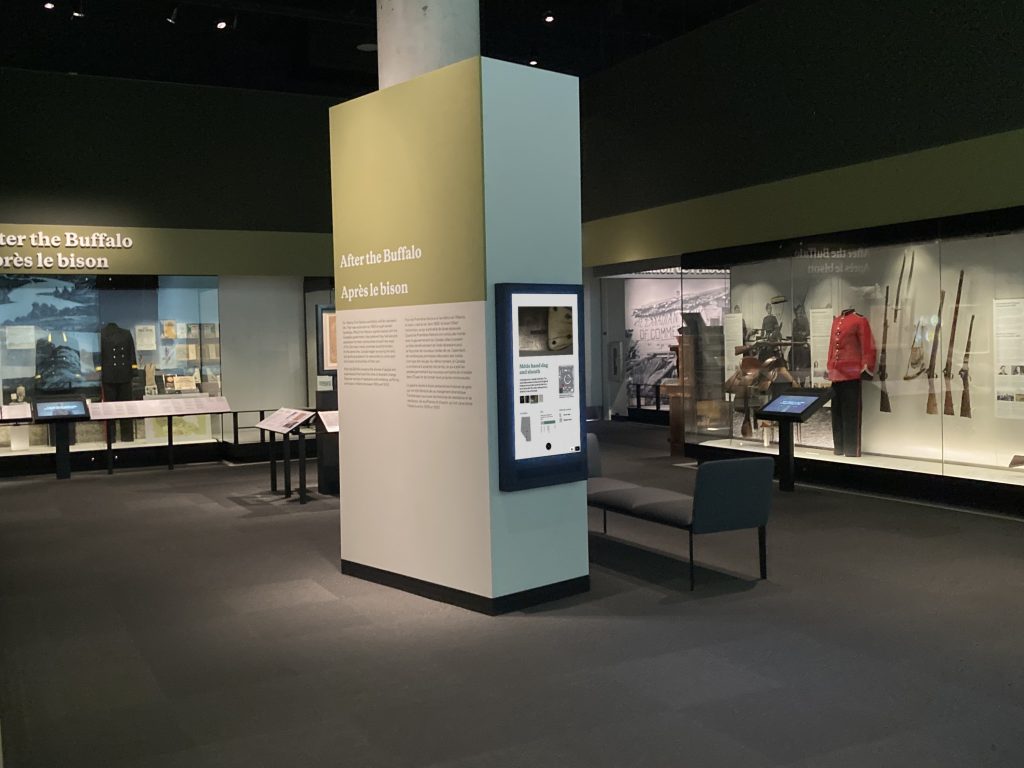
Example Gallery Screen in the finished exhibit
Indigenous Placenames Interactive
A feature exhibit in the Human History Hall is a large physical wall map of the province of Alberta. What makes this map different however is its inclusion of more than 700 indigenous placenames. This “Placenames” database represents a tremendous amount of work by RAM staff in collaboration with First Nations knowledge keepers. One of the takeaways for the visitor is to simply realize that pre-settler “Alberta” was a fully-explored, inhabited and indeed – named – region. As one can clearly see on the map, many locales were named in different languages.
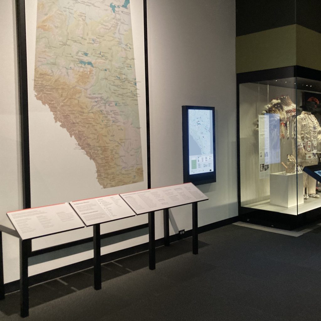
EDM’s Indigenous Placenames interactive beside its physical counterpart
EDM’s role was provide a digital accompaniment to the physical map, one that facilitated exploration and discovery. The final interface allows visitors to filter map locations by cultural group, geographic feature, location within the province using the pan/zoom features. The interface itself can also be toggled between English and French.
The following screenshot shows the default state of the interactive. At this scale, map features are aggregated and displayed only as starred circles/squares. Colour is used to indicate cultural group: if one looks closely, many circles have multiple colours – an indication that this place was known to different cultural groups.
")
")
Using the interface at the bottom, the visitor can quickly move around the map, turn on/off indicators for different cultural groups, and show/hide different types of features. The fluid interface invites exploration. (Note that keeping interaction to the bottom third of the wall-mounted screen allows makes the interactive accessible or visitors using a wheelchair.)
If one zooms in, geographic feature icons appear along with indigenous names. The omission of highways and regional roads and the main map is intentional … as is their inclusion on the schemaic map at bottom as a navigational aid.
")
")